
Cascading impacts analysis and recovery optimisation for the Canterbury Lifeline Utilities Group
- Post by: Logan Brunner
- September 3, 2024
- Comments off
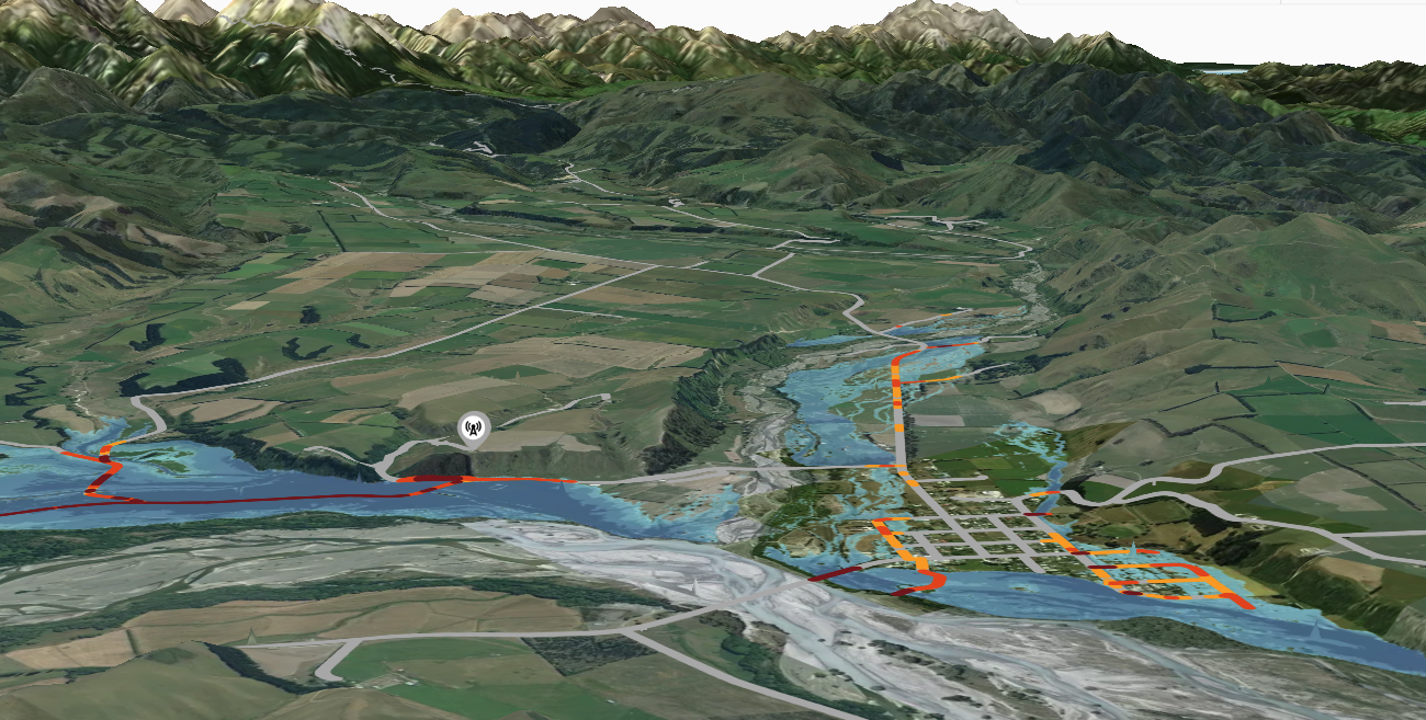
Over the past year, our team has been busy with a project for the Canterbury Lifeline Utilities Group, where we mapped out the potential natural hazard risks to our utility, council, and household infrastructure throughout Canterbury. We worked alongside IAM Consulting, Urban Intelligence, and Resilient Organisations to collect over 160 infrastructure datasets and 29 natural hazard layers (spanning over 70 different hazard scenarios) which we displayed in a map viewer. Logan Brunner, a PhD candidate in our lab, applied his model for interdependent infrastructure to map cascading impacts from the electricity network to properties and developed an optimisation model to convey what the recovery could look like. These results were further used within the MERIT model to understand the wider economic impacts of the hazards.
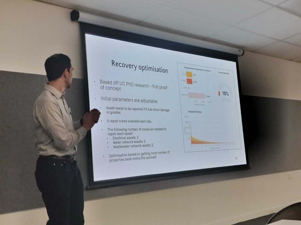
During the first week of August, Logan and Tom helped host two workshops in Woodend and Timaru to show the map viewer, present the cascading impacts and optimisation findings, and discuss the results to refine the model assumptions. Overall, the council and lifeline attendees were excited about the work and in incorporating these findings to improve their understanding of potential risks!